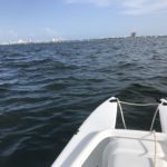
Florida is… #BiscayneBay
Explore it!
From Wiki: Biscayne Bay (Bahía Vizcaína in Spanish) is a lagoon that is approximately 35 miles (56 km) long and up to 8 miles (13 km) wide located on the Atlantic coast of South Florida, United States. It is usually divided for purposes of discussion and analysis into three parts: North Bay, Central Bay, and South Bay. Its area is 428 square miles (1,110 km2). The drainage basin covers 938 square miles (2,430 km2).
In 1975, the bay was designated as a state aquatic preserve. The aquatic preserve spans the entirety of Biscayne Bay from Oleta River in the north to Card Sound in the south, with the exception of the central part of the bay, which is Biscayne National Park. A second preserve was soon added off of Cape Florida on Key Biscayne, which became known as the Cape Florida to Monroe County Line Preserve. These two preserves are now managed by the state of Florida under the Biscayne Bay Aquatic Preserves. Seven remaining houses of Biscayne Bay’s Stiltsville settlement are now within the boundaries of this National Park which was established in 1980. Much of Biscayne National Park was designated as a National Monument in 1967. Barnes Sound lies within the Florida Keys National Marine Sanctuary. In regards to wildlife, bottlenose dolphins and Florida manatees can be observed in the bay.
The bay has been known by several names. Juan Ponce de León called it Chequescha in 1513. Pedro Menéndez de Avilés called it Tequesta in 1565. The British, during their occupation of Florida, called the bay Cape River, Dartmouth Sound, and Sandwich gulph. Hernando de Escalante Fontaneda related that a sailor from the Bay of Biscay called the Viscayno or Biscayno had lived on the lower east coast of Florida for a while after being shipwrecked, and a 17th-century map shows a Cayo de Biscainhos, the probable origin of Key Biscayne. The bay was known as Key Biscayne Bay in the 19th century, finally shrinking to Biscayne Bay late in the 19th century.

